Jump to Content

Over 30 years’ experience in manufacturing innovative products and delivering customer-focused services
- Leak detection
- Water sustainability
- Oil storage maintenance & compliance
- Drainage & interceptor maintenance
- Flood defence
Over 30 years’ experience in manufacturing innovative products and delivering customer-focused services
Fields marked with * are required.
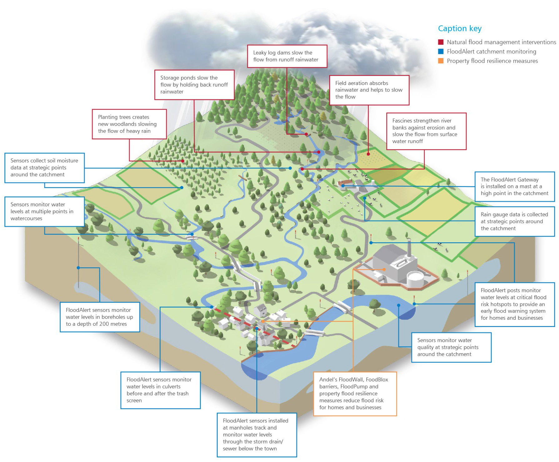
Andel FloodAlert bollards and drain gulley sensors provide continuous monitoring for flood warnings and real-time water level data collection at high-risk locations. When multiple FloodAlert sensors are deployed, they create a network that enhances flood risk management, offering valuable insights across a wider area.
FloodAlert sensors can track real-time data on groundwater, surface water, and watercourse water levels, which can be displayed on the FloodAlert portal and integrated with other datasets for improved modeling and more effective flood risk management.
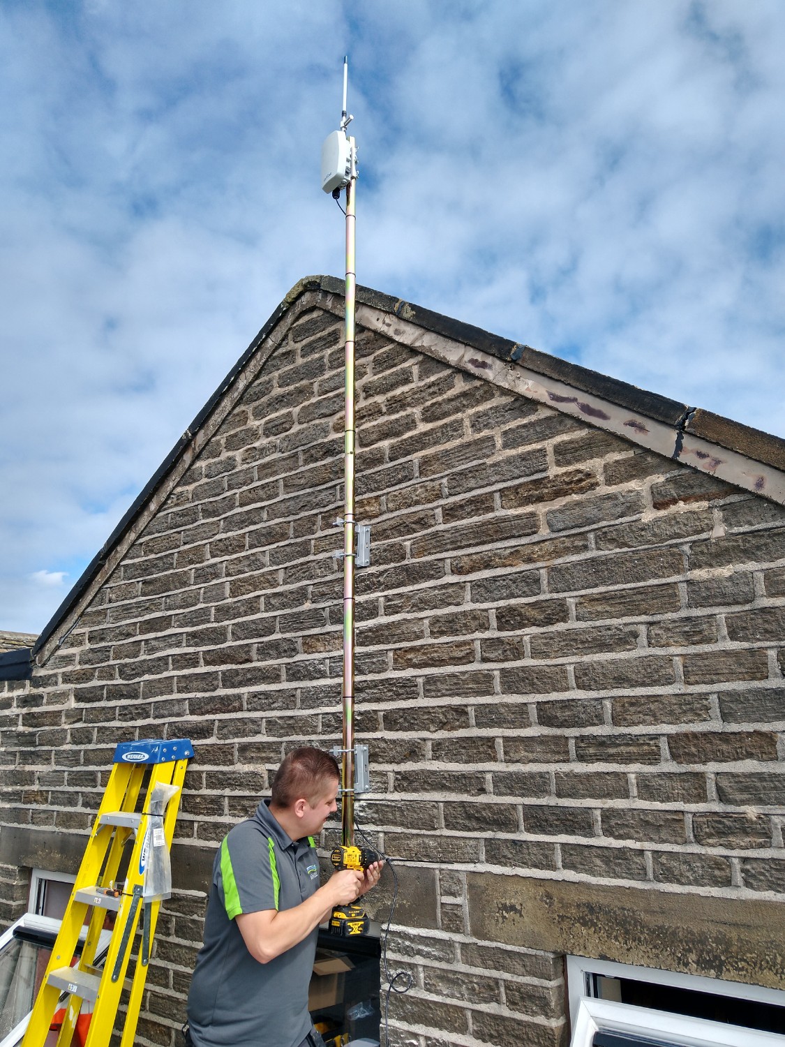
A single gateway connects to all devices and communicates all data to a central network server.
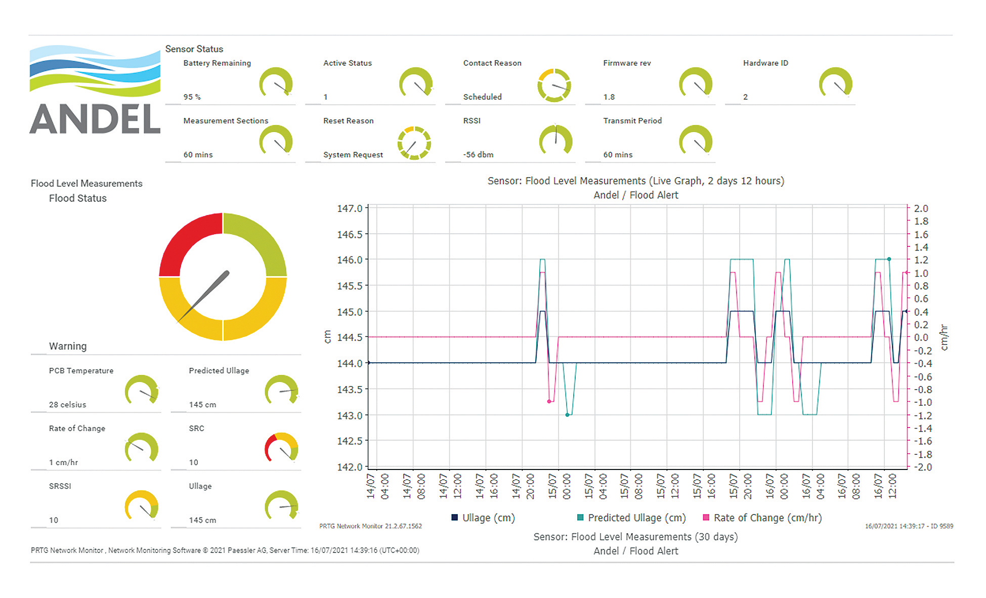
FloodAlert provides live monitoring on a secure, cloud-based portal, accessible from any device connected to the internet. Information from multiple data sources is visualised in an easy-to-use dashboard with a simple traffic light green, amber and red warning system.
FloodAlert tracks and monitors water levels at multiple locations as runoff rainwater travels down hillsides to lower ground in watercourses, below and around urban communities and into rivers.
FloodAlert sends SMS and email early warnings for fluvial and pluvial flooding.
FloodAlert collects real-time water level data in groundwater, surface water and watercourses and merges the information with flood risk variables such as 36-hour rainfall forecast data, ground rain gauge data, soil moisture ground saturation data and Environment Agency river level data.
A real-time digital map can be created and used to produce meaningful data such as trend analysis, diagnostic analysis and predictive failure analysis.
FloodAlert monitors the effect of natural flood management interventions, before, during and after.
FloodAlert is a sustainable, low-carbon impact method of influencing land use practices on a catchment scale. It also develops stakeholder trust, reduces flood risk and increases resilience.
To meet rising demand, Andel is expanding its network of approved flood defence installation partners throughout the UK. We welcome skilled contractors who share our commitment to safeguarding people, property and the environment. If you’re interested in working with a trusted, established brand committed to protecting people, property and the environment, we’d love to hear from you.